Dec 29, 2022
4 min read
Nepal Earthquake: Report from OpenStreetMaps Situation Room- Day 4 (April 29)
Kathmandu Living Labs
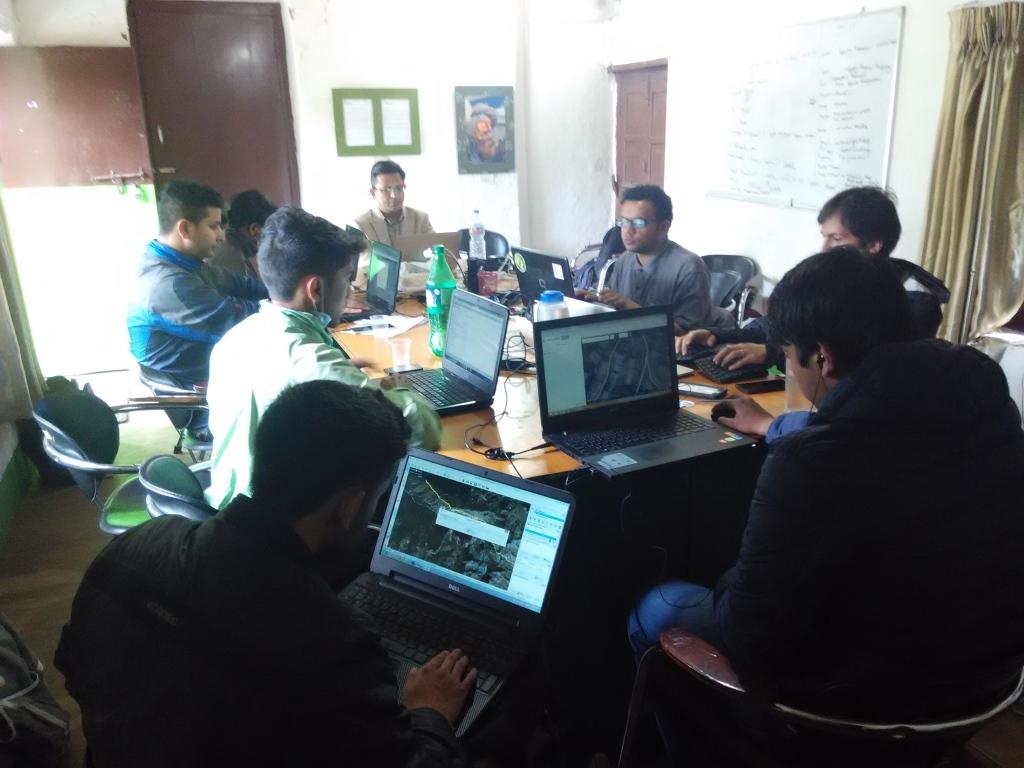
It has been another busy and full day in the Kathmandu Living Labs Situation Room.
QuakeMap.org gets more uptake
Quakemap.org has seen an increase in use and growth. A total of 445 reports have been submitted thanks to the hard work of our team. Users can now submit reports via SMS to the following numbers: Ncell: 9802017413 or NTC: 9860782874.
Many local teams who were planning on creating similar efforts have begun to co-ordinate with us rather than duplicating efforts. Bibeksheel Nepali and the Nepal Earthquake Relief Volunteer Coordination team have joined forces with KLL to create a call center. This call center went live today and will solicit and receive responses to quakemap.org.
We also created a guide on “How Maps can Help Earthquake Relief,” which guides people on how they can use and contribute to the mapping products that we are creating on behalf of the International mapping community.
Continued Mapping
Over 2220 mappers around the world continue to make edits to OpenStreetMaps to help relief efforts. This includes over 1380 new mappers, who have joined OSM since the Nepal Earthquake. The mapping effort has been covered in major US News firms such as FastCompany, Wired, and others.
KLL member Nirab Pudasaini has joined HOT’s Maning Samble and Pierre Beland to take an active lead in defining tasks to guide the International HOT community. We are beginning to saturate the mapping tasks based on pre-disaster imagery, focusing on the communities and areas that are most affected.
OSM Maps reach Rescue Workers
We are starting to see the demand for our mapping products increase. In the very initial aftermath of the Earthquake, responders just left towards affected areas. But now that the dust has settled, many have begun taking a more planned approach. We have had requests for mapping data from the Nepal Army and Red Cross, as well local relief groups headed to Gorkha, and International actors like the Qatar Crisis Response team. We have continued to update the maps available at http://bit.ly/nepalmaps, and added a visualization of deaths and injuries at the district level as released by the National Information Technology Center.
Satellite Imagery, and Next Steps The OSM community has been creating maps based mostly on pre-disaster imagery. The 130,260 buildings and 14,273 pieces of road that have been added to the map have been digitized from pre-disaster imagery. This is crucial information, but is not enough.
Digital Globe has been incredibly generous to release post-disaster imagery of the Kathmandu city area, with licenses so that we can use that data for mapping in OSM. This has been very helpful, for example to map all of the IDP camps spread out around the city. However, information about Kathmandu has been and can be collected using other sources. Connectivity and transportation in the Kathmandu core city area is back up.
What is crucial now for us to have Satellite imagery outside of Kathmandu core city area. We have been getting requests left and right from relief organizations about how we can help them with damage assessments so they can co-ordinate relief efforts. From the areas outside of core Kathmandu city which are highly affected (refer to map of injuries below), it has been harder to get information about effects. Damage in districts like Sindhupalchowk is massive, and having imagery to assess damage and direct relief would be amazing.
We are already co-ordinating with Digital Globe, whose generosity has been great. We request any and all Satellite imagery provides reading this to release imagery outside of Kathmandu core city, focusing on full coverage of those areas that have been hit hard by the earthquake.
In the meantime, we are also looking slower approaches like UAV imagery and the very slow and expensive field assessment.
Kathmandu Living Labs
Read More from our Blog
Subscribe to our Newsletter
Contact Details
1474 Lamtangin Marg, Chundevi
+977-1-4720136
contact@kathmandulivinglabs.org

Copyright 2023. Kathmandu Living Labs. All Rights Reserved

